Dates des itinéraires
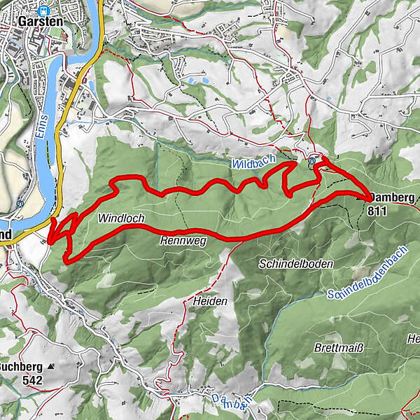
12,11km
326
- 805m
504hm
512hm
03:59h

- Brève description
-
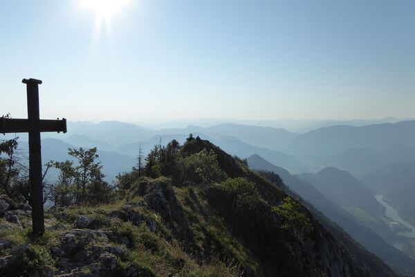
Circular trail from Landhotel Eckhard past Gasthof Schoiber to Dambergwarte and back via Rennweg
- Difficulté
-
moyen
- Évaluation
-
- Parcours
-
Windloch1,6 kmDamberg (811 m)4,8 kmDambergwarte4,9 km
- Meilleure saison
-
janv.févr.marsavrilmaijuinjuil.aoûtsept.oct.nov.déc.
- Hauteur maximale
- 805 m
- Point de mire
-
St. Ulrich/Landhotel Eckhard
- Profil en hauteur
-

- Auteur
-
La randonnée Circular Trail Damberg with Bible Path est utilisé par outdooractive.com fourni par.
GPS Downloads


Informations générales
Point de rassemblement
Prometteur
Autres parcours dans les régions
-
Traunviertel
1961
-
Tourismusregion Bad Hall
776
-
St. Ulrich bei Steyr
294