


Dates des itinéraires
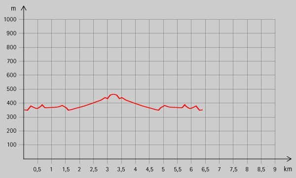
6,1km
351
- 437m
102hm
02:00h
- Brève description
-
Schöne Wanderung von Reichraming bis zu einem Gasthaus.
- Évaluation
-
- Point de départ
-
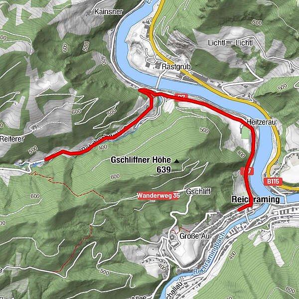
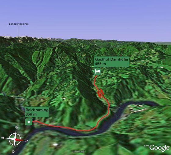
Ortsplatz von Reichraming (356 m)
- Parcours
-
Pfarrkirche Reichraming0,0 kmReichraming0,1 kmGasthaus Aglas0,1 kmGasthaus Damhofer (Forellenwirt)3,0 km
- Hauteur maximale
- 437 m
- Repos/Rassembler
-
GH Aglas, GH Damhofer;
- Cartes

GPS Downloads


Nature du chemin
Asphalte
Gravier
Pelouse
Forêt
Rocher
Exposé
Autres parcours dans les régions
-
Traunviertel
1940
-
Steyr und die Nationalpark Region
1371
-
Reichraming
363


