Dates des itinéraires
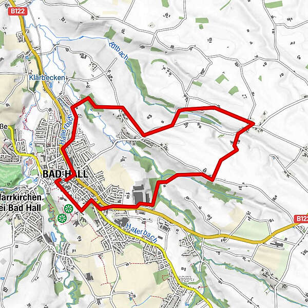
9,67km
347
- 408m
103hm
03:00h
- Brève description
-
12 Waldandacht Rundwanderweg
- Difficulté
-
facile
- Évaluation
-
- Parcours
-
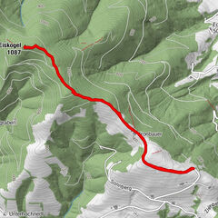
Bad HallOrtmühle2,2 kmGroßmengersdorf4,4 kmLandgasthaus Bachmayr4,5 kmKleinmengersdorf6,7 kmBad Hall9,3 km
- Meilleure saison
-
janv.févr.marsavrilmaijuinjuil.aoûtsept.oct.nov.déc.
- Hauteur maximale
- 408 m

GPS Downloads


Nature du chemin
Asphalte
(75%)
Gravier
(10%)
Pelouse
(10%)
Forêt
(5%)
Rocher
Exposé
Autres parcours dans les régions
-
Traunviertel
1940
-
Tourismusregion Bad Hall
770
-
Bad Hall
141