
© Markus Haslinger
© Donau NÖ Tourismus/Robert Herbst

© Donau NÖ Tourismus/Robert Herbst

© Donau NÖ Tourismus/Robert Herbst

© Donau NÖ Tourismus

© Donau NÖ Tourismus/JS

- Brève description
-
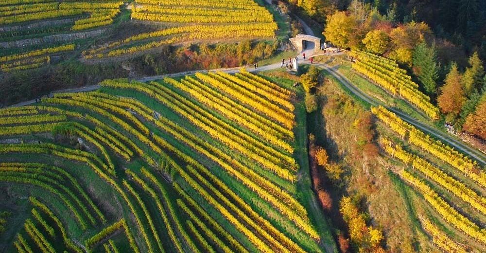
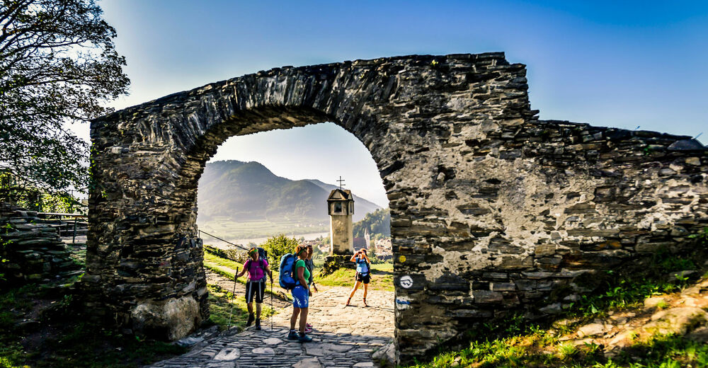
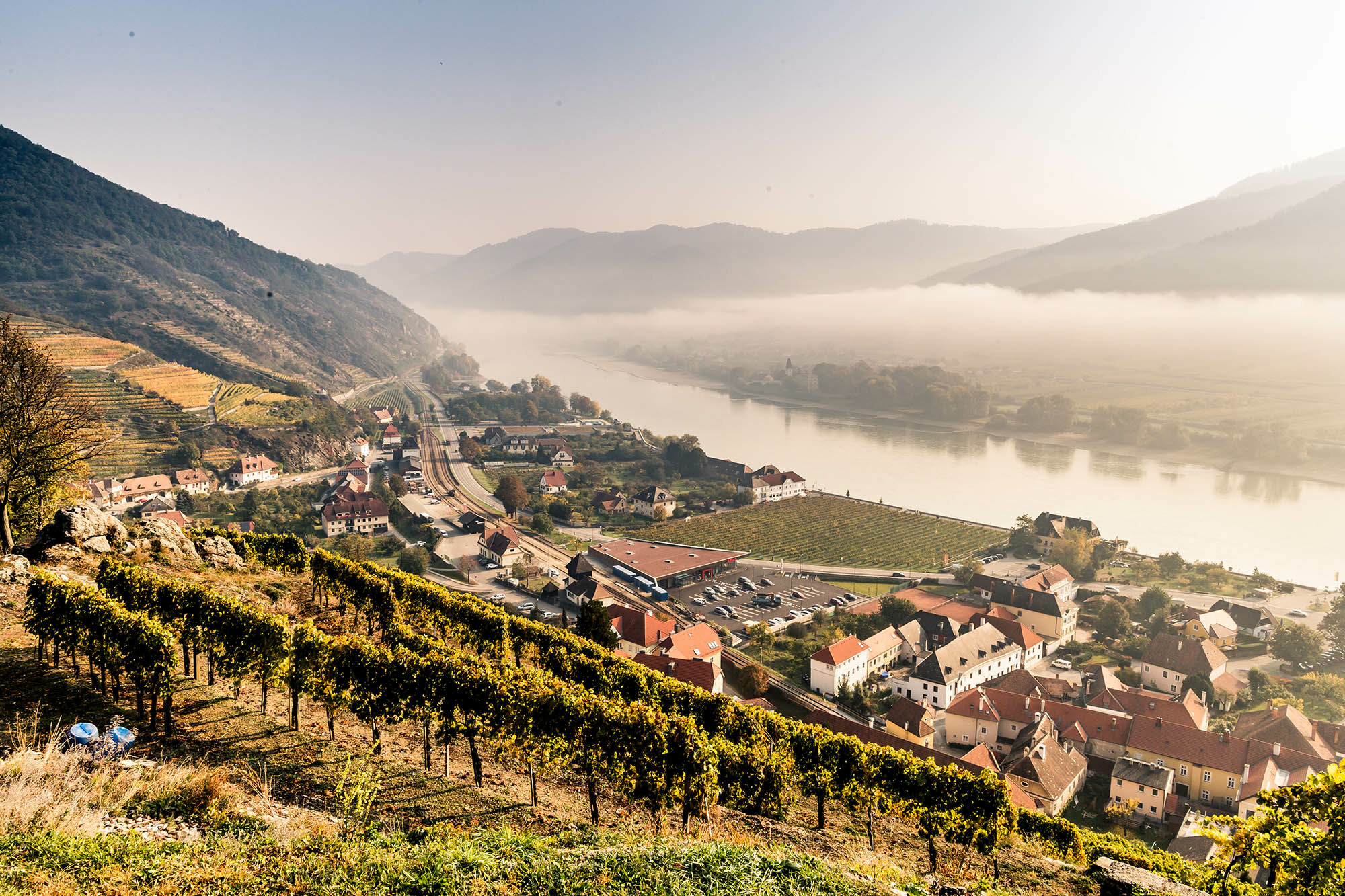
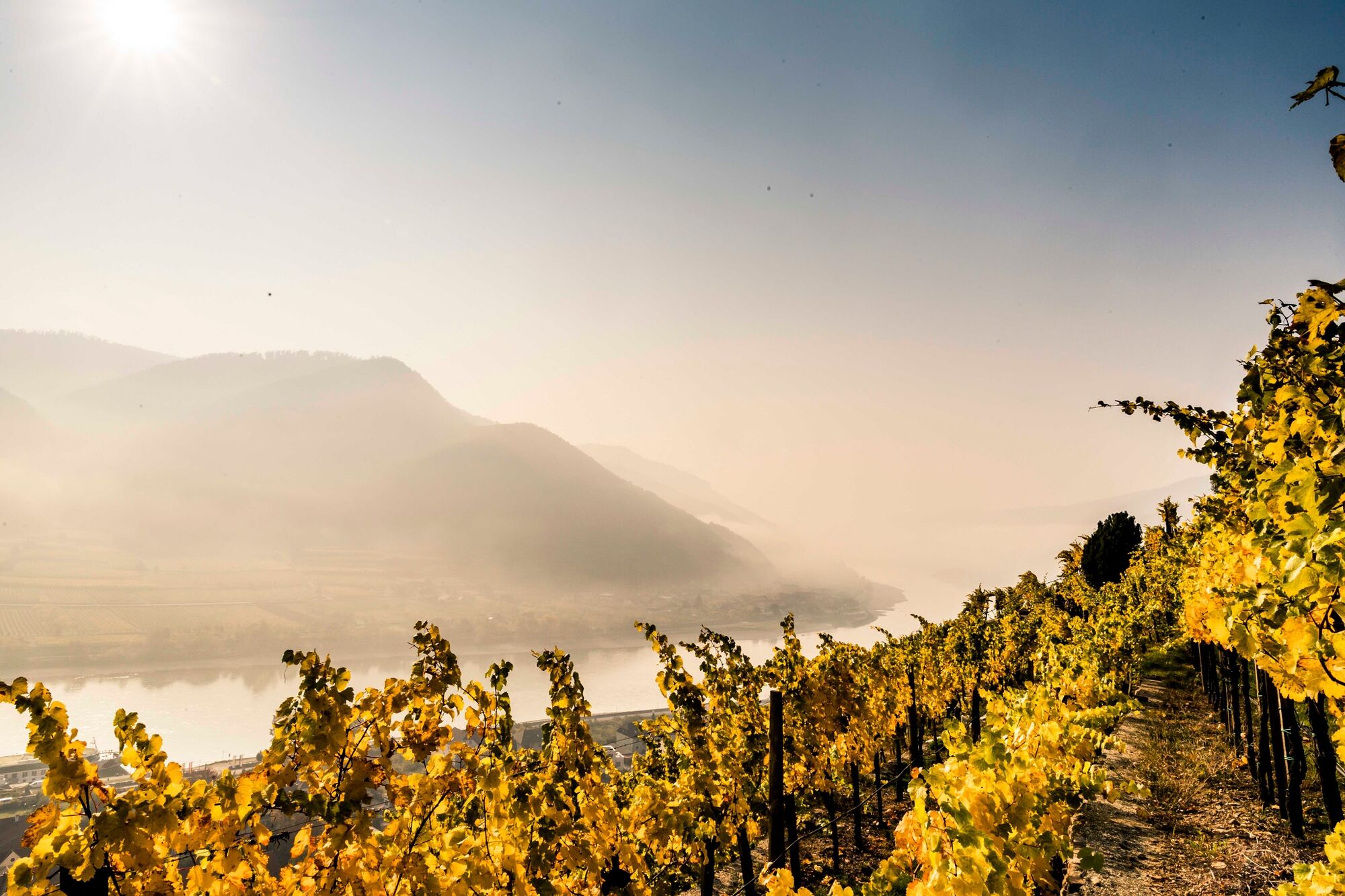
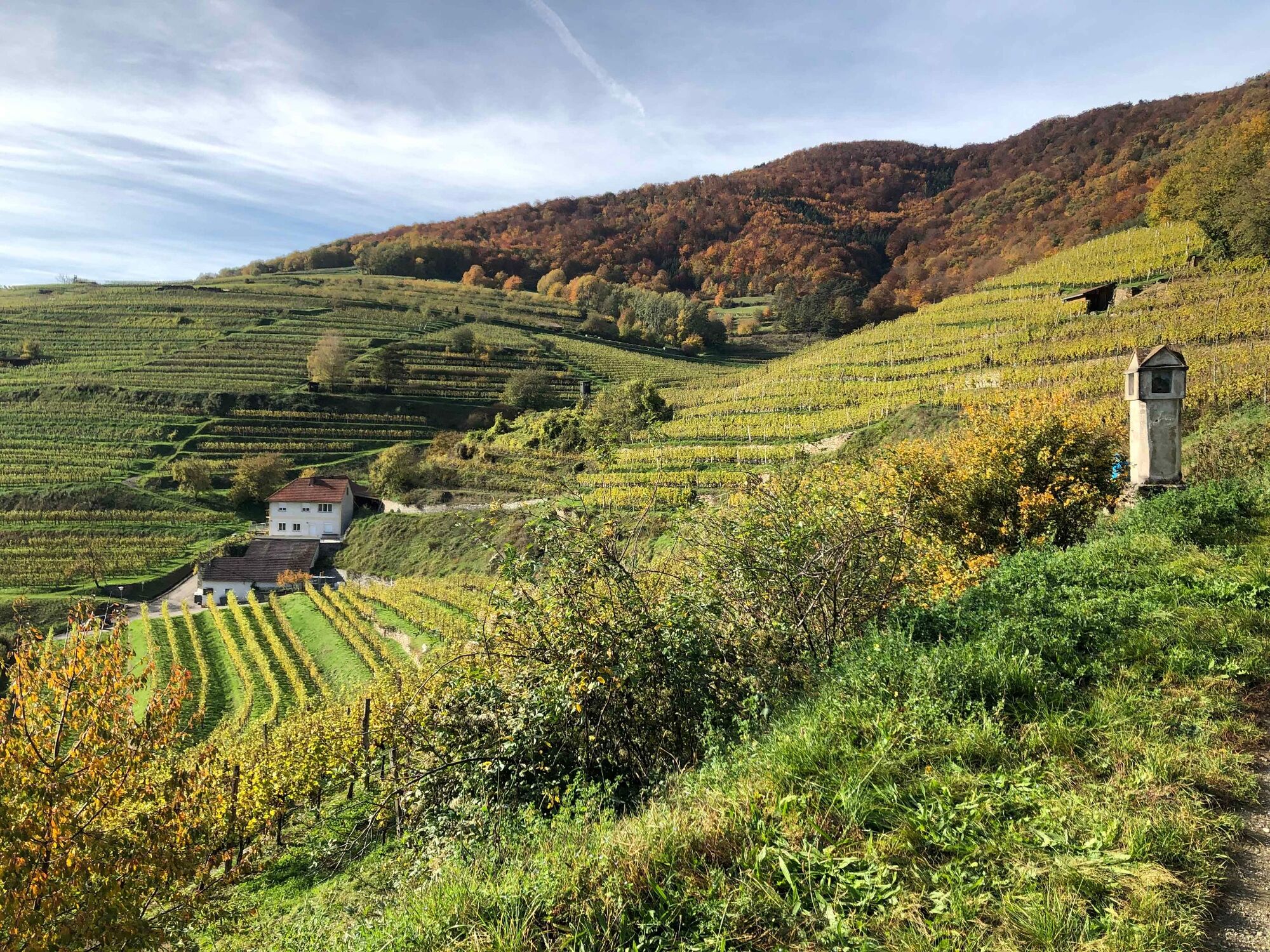
Spitz and the Wachau, there are immediately sweet wine landscapes and centuries-old stone terraces, noble white wines, such as green Veltliner and Riesling, romantic land lots, Heurigengärten, Baroque reading yards, the Danube and apricots in the sense, and rightly so: You walk on Spitzer wine trail The most famous Spitzer Weinrieden, enjoy wonderful vistas and views in the Wachau and dive into the viticulture and the reed culture of the Spitzer winegrowers. The trail is signposted with wine bottles.
- Difficulté
-
facile
- Évaluation
-
- Parcours
-
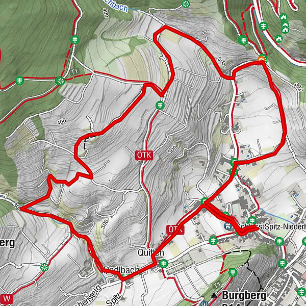
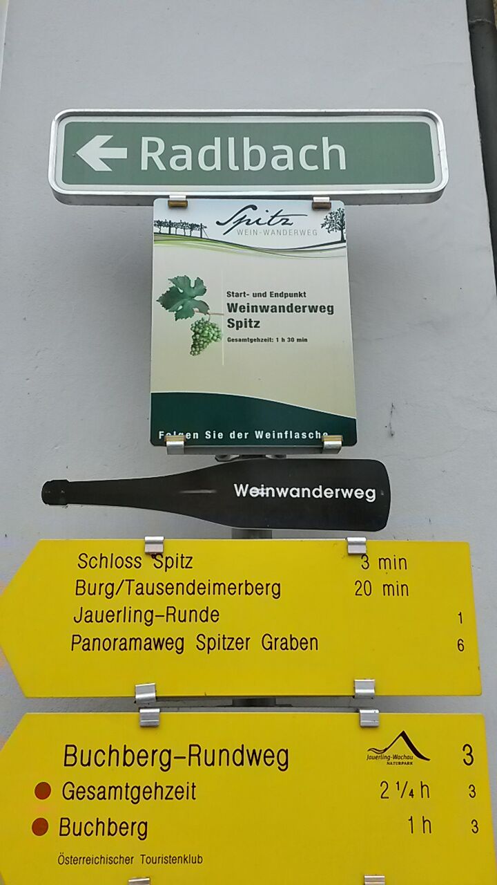
Pfarrkirche hl. MauritiusRadlbach3,5 kmQuitten3,7 km
- Meilleure saison
-
janv.févr.marsavrilmaijuinjuil.aoûtsept.oct.nov.déc.
- Hauteur maximale
- 372 m
- Point de mire
-
Spitz, Kirchenplatz
- Profil en hauteur
-


- Auteur
-
La randonnée Wine hiking trail Spitz est utilisé par outdooractive.com fourni par.
GPS Downloads


Informations générales
Point de rassemblement
Culturel/Historiquement
Faune
Prometteur
Autres parcours dans les régions


