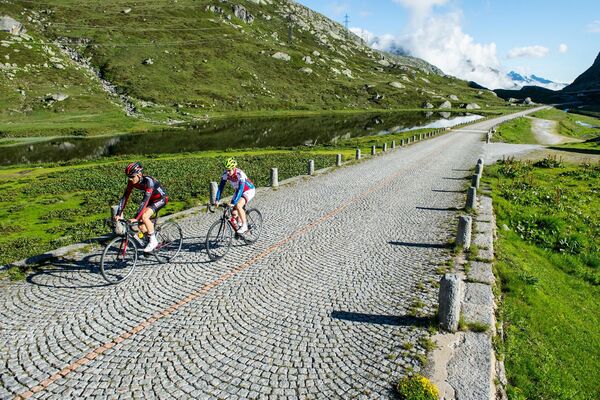
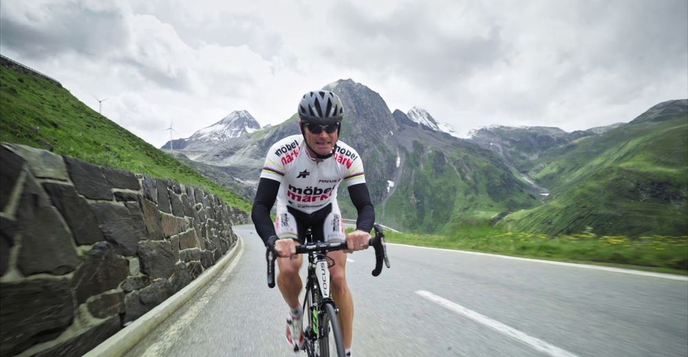
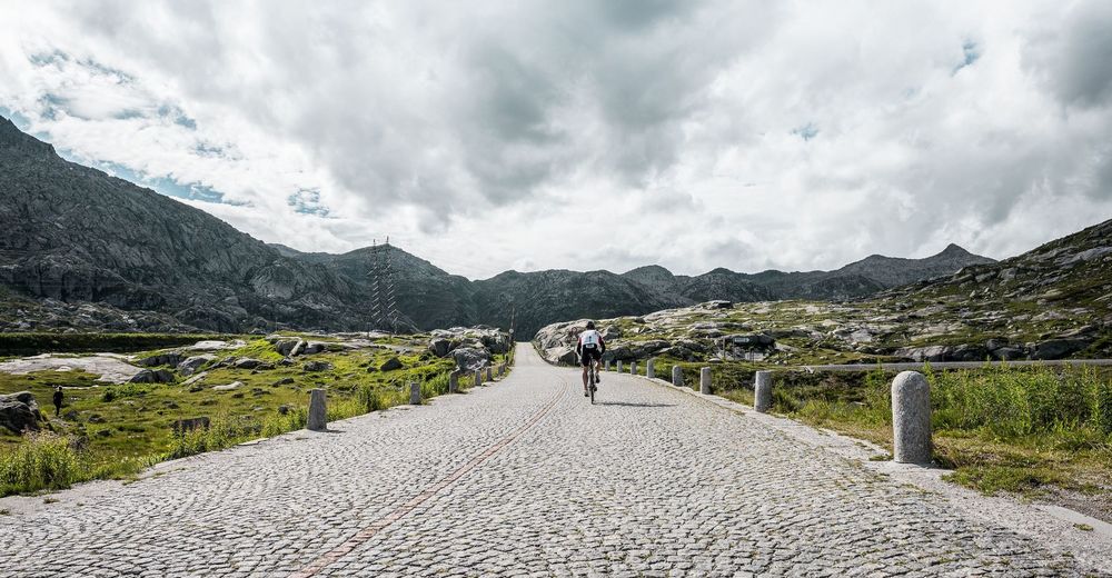
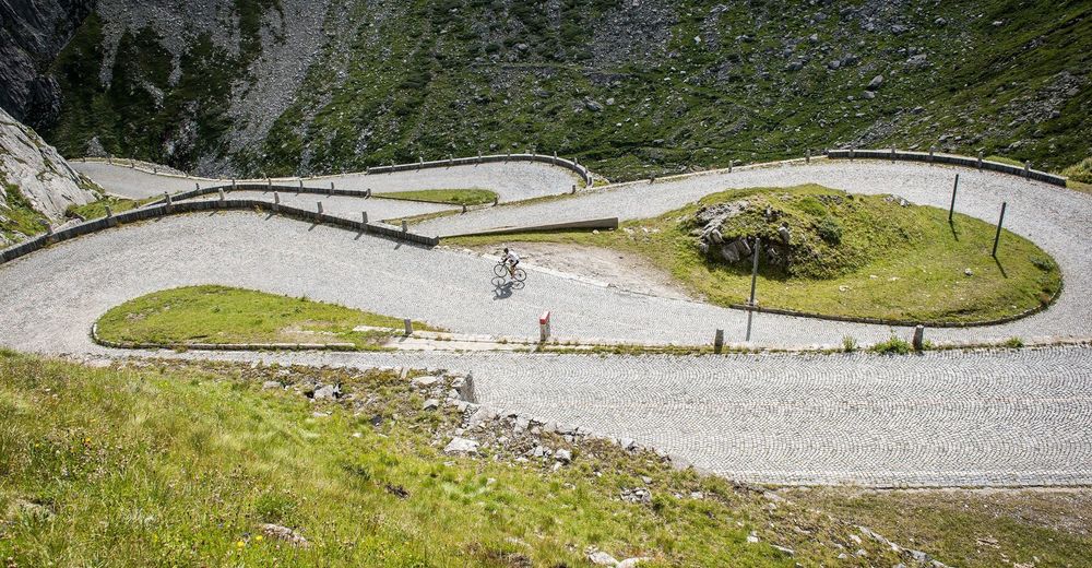
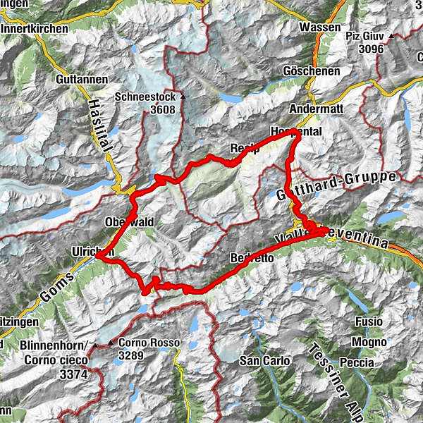
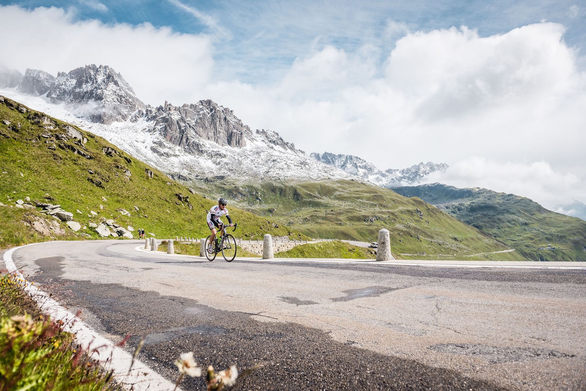
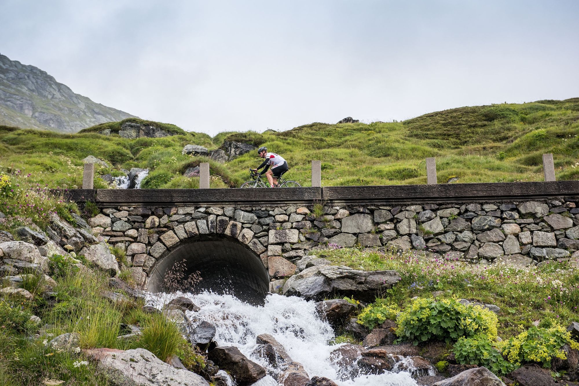
Three passes, three cantons and 3100 metres of elevation gain

Vélo de course
© MySwitzerland
© Region Luzern-Vierwaldstättersee - Schweiz Tourismus
© Region Luzern-Vierwaldstättersee - Schweiz Tourismus
© Region Luzern-Vierwaldstättersee - Schweiz Tourismus
© Region Luzern-Vierwaldstättersee - Schweiz Tourismus
© Region Luzern-Vierwaldstättersee - Schweiz Tourismus
© Region Luzern-Vierwaldstättersee - Schweiz Tourismus

© Region Luzern-Vierwaldstättersee - Schweiz Tourismus
Dates des itinéraires
95,34km
1.143
- 2.478m
2.811hm
2.723hm
07:17h

- Brève description
-
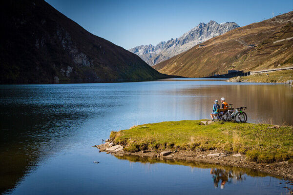
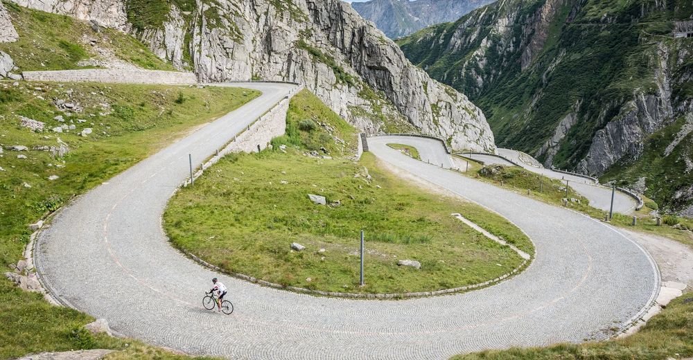
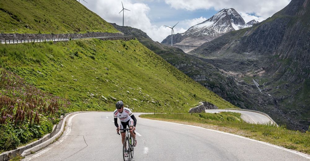
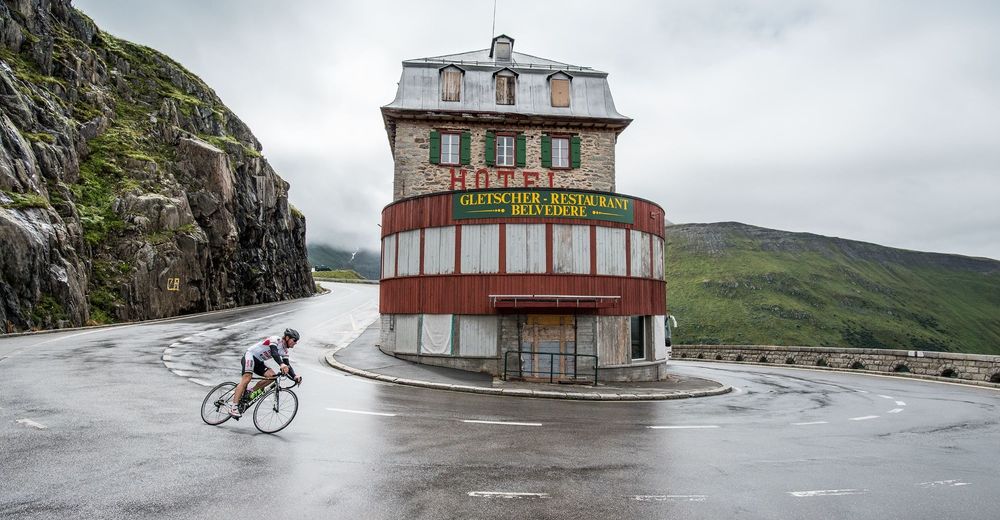
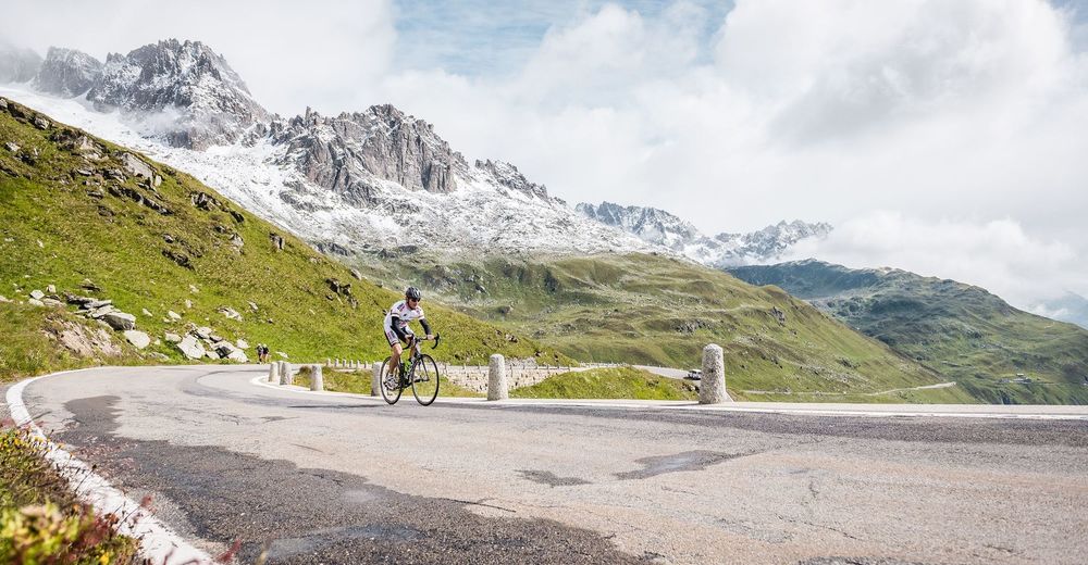
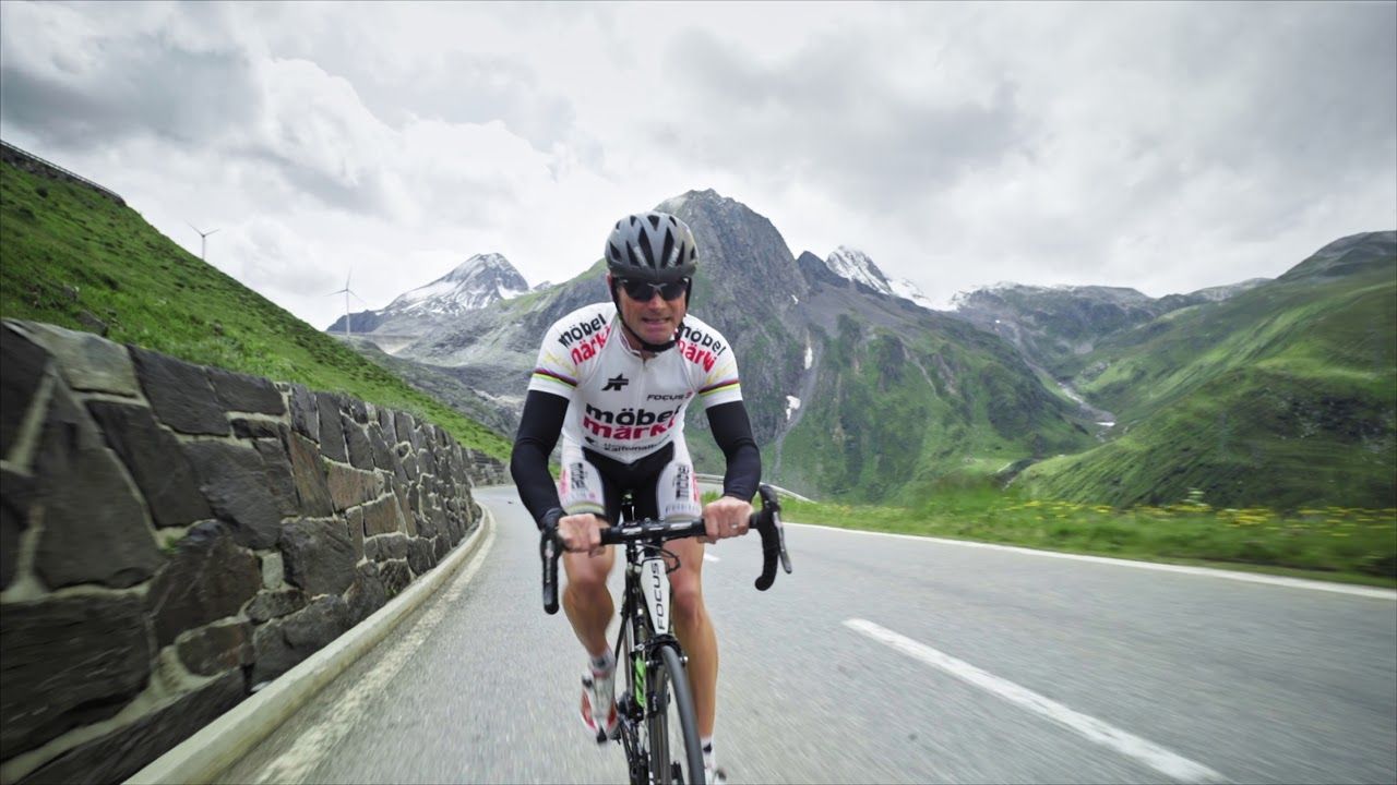
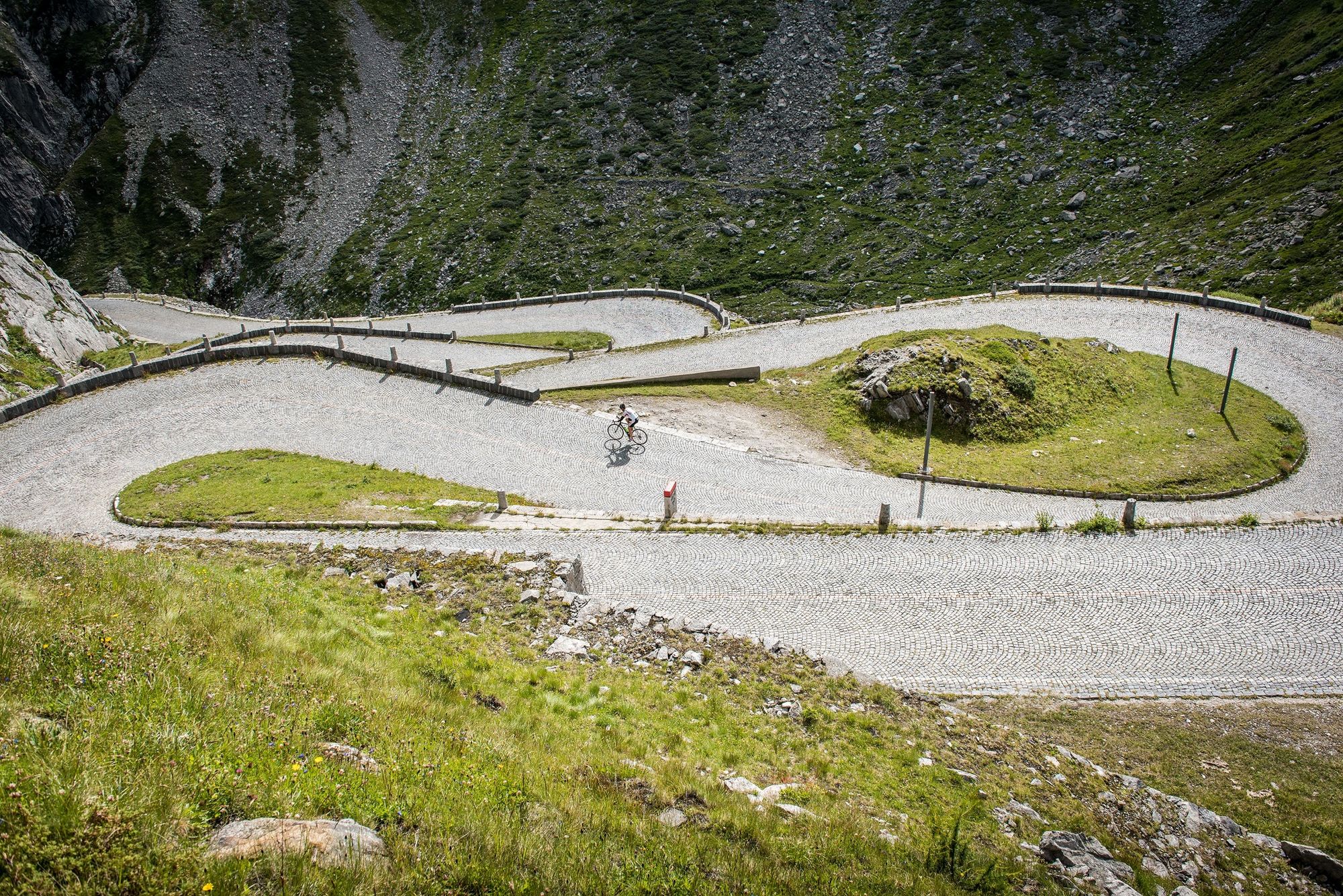
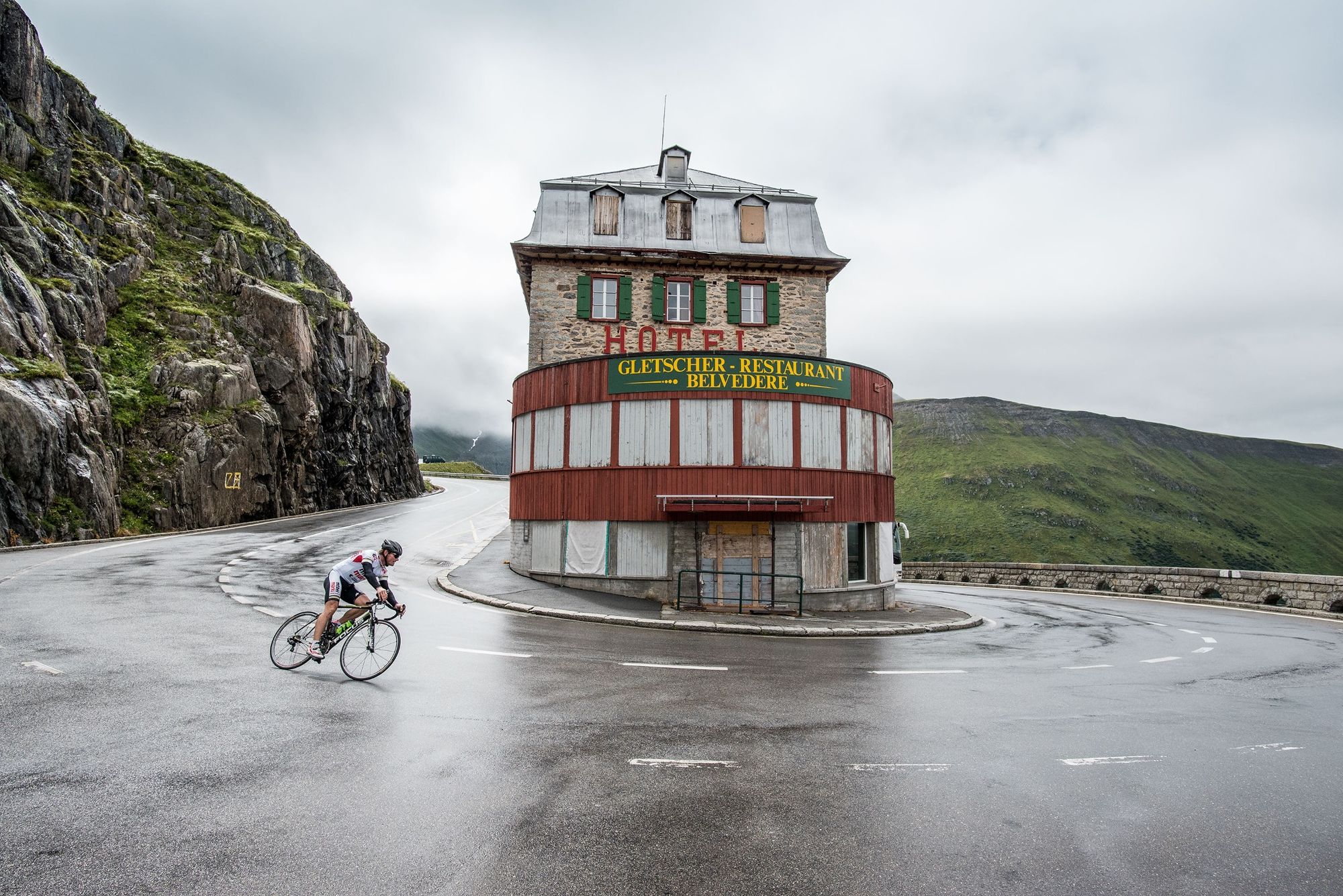
Around Andermatt are eight legendary alpine passes, all waiting to be crossed. The Gotthard Region offers fascinating alpine scenery, Swiss history, civil engineering masterpieces – and a wealth of bends!
- Difficulté
-
difficile
- Évaluation
-
- Parcours
-
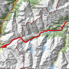
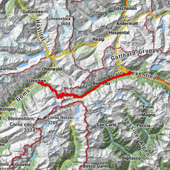
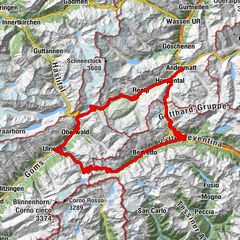
ObergadmenHospental (1.493 m)GüetliCentral0,0 kmZum Dörfli2,3 kmRealp (1.538 m)5,4 kmPfarrkirche Heilig Kreuz5,5 kmTiefenbach11,5 kmFurka16,0 kmRestaurant Furkablick16,0 kmGletsch (1.757 m)26,8 kmGletsch (1.759 m)27,0 kmRhonequelle29,9 kmSt. Niklaus31,9 kmOberwald (1.377 m)33,1 kmKirche Heilig Kreuz33,1 kmBinelti33,2 kmPizzeria al Ponte33,2 kmFurka33,3 kmObergesteln (1.355 m)36,3 kmHubertus36,3 kmUlrichen (1.346 m)37,7 kmWalser37,9 kmWeid38,7 kmNufenen-Passhöhe49,9 kmAll'Acqua60,8 kmCioss Prato61,5 kmSelva62,7 kmBedretto (1.402 m)64,5 kmVilla Bedretto65,2 kmOssasco66,7 kmBombel67,8 kmFontana68,6 kmCioss di Dentro69,6 kmCioss di Fuori70,8 kmAirolo (1.142 m)73,3 kmAirolo (1.175 m)73,4 kmSan Carlo73,8 kmFondo del Bosco75,8 kmScima du Bòsc'77,9 kmMotto Bartola78,0 kmTramiòra82,8 kmSan Gottardo85,4 kmScuderia85,6 kmAlte Sust85,6 kmOspizio del San Gottardo (2.091 m)85,6 kmGotthardpass 2106m86,2 kmMätteli91,2 kmGüetli94,5 kmObergadmen95,2 kmCentral95,2 kmHospental (1.493 m)95,3 km
- Meilleure saison
-
janv.févr.marsavrilmaijuinjuil.aoûtsept.oct.nov.déc.
- Hauteur maximale
- 2.478 m
- Point de mire
-
Hospenthal
- Profil en hauteur
-
 © outdooractive.com


-

-
AuteurLa randonnée Three passes, three cantons and 3100 metres of elevation gain est utilisé par outdooractive.com fourni par.
GPS Downloads


Informations générales
Point de rassemblement
Culturel/Historiquement
Prometteur