Naul walking trail (suitable for baby carriages)
facile
Randonnée
Naviguer
Naviguer
Télécharge cette visite sur ton portable
Carte
Naul walking trail (suitable for baby carriages)
facile
Randonnée
1,60 km
Scanner le code QR et commencer la navigation dans l'application bergfex
QR Code
Randonnée & tracking

Naul walking trail (suitable for baby carriages)

Distance
1,60 km
Durée
00:30 h
Ascension
41 m
Altitude
1 264 - 1 298 m
Téléchargement de la piste
Carte
Naul walking trail (suitable for baby carriages)
facile
Randonnée
1,60 km

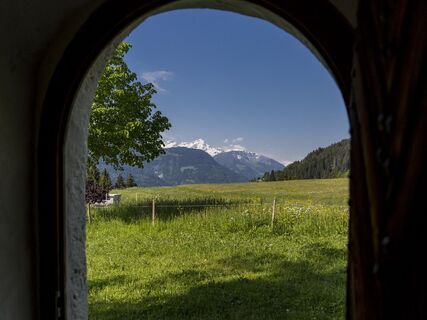
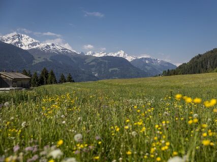
The start of the hike is at the St. Jakob / S. Giacun chapel (on the left).After a few meters you will reach a stable on the left side of the road. The donkeys and sheep enjoy the idyllic peace and quiet...


Description

The start of the hike is at the St. Jakob / S. Giacun chapel (on the left).After a few meters you will reach a stable on the left side of the road. The donkeys and sheep enjoy the idyllic peace and quiet in the adjacent meadow.After the stable, follow the path to the right into the forest. With a bit of luck, you will see squirrels playing in the trees.Before you leave the forest completely, two benches invite you to linger.

Treat yourself to a short break in the immediate vicinity.

Note: Chapel keys are available from the Brigels information office or the Hotel Alpina.

The trail markings in the description of this tour are based on the 1:25000 hiking map for Brigels, Waltensburg, Andiast. The hiking map is available from the Brigels information office, the Volg Andiast and Waltensburg shops and the Hotel Postigliun in Andiast.

Parcours
Sogn Giacun
(1 302 m)
Lieu de culte
0,0 km
Parcours
Carte
Naul walking trail (suitable for baby carriages)
facile
Randonnée
1,60 km
Sogn Giacun
(1 302 m)
Lieu de culte
0,0 km
Description

Short time-out.

Technique
1 / 6
Endurance
1 / 6
Paysage
4 / 6
Expérience
3 / 6
Meilleure période de l'année
Jan
Fév
Mar
Avr
Mai
Jun
Jul
Aoû
Sep
Oct
Nov
Déc
Partager la visite
Carte
Naul walking trail (suitable for baby carriages)
facile
Randonnée
1,60 km
Erreur
Une erreur s'est produite. Veuillez réessayer.
Pas encore d'évaluation
Écrire une évaluation

Les évaluations aident les autres utilisateurs à choisir leur prochaine aventure. Veuillez évaluer uniquement l'excursion, pas la météo ni votre casse-croûte.

Choisissez une des étoiles pour évaluer la visite
Mauvaise visite
Tour faible
Tour moyen
Bonne visite
Excellente visite
bergfex logo Obtenez un aperçu Toujours en direct avec plus de 9.500 webcams. En tant qu'utilisateur Pro, vous pouvez désormais voir les webcams correspondantes à de nombreuses randonnées dans l'application de randonnées de bergfex. Vous pouvez ainsi voir directement les conditions actuelles.
Randonnée et suivi

Randonnée et suivi

Randonnée et suivi
Plus de 550.000 propositions de circuits, des cartes détaillées et un planificateur d'itinéraire intuitif font de cette application un must pour tous les passionnés de nature.
Randonnée et suivi