
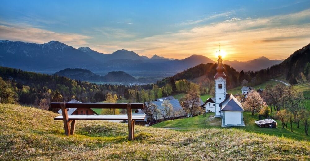
© Turizem Bled - Jošt Gantar

- Brève description
-
The trail over Kupljenik is quite picturesque, but relatively long, and your efforts will be awarded with interesting sights and diversity.
- Difficulté
-
moyen
- Évaluation
-
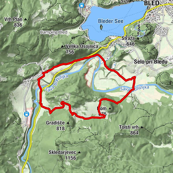
- Parcours
-
Bohinjska Bela0,2 kmKupljenik2,9 kmLog6,1 km
- Meilleure saison
-
janv.févr.marsavrilmaijuinjuil.aoûtsept.oct.nov.déc.
- Hauteur maximale
- 652 m
- Point de mire
-
Heart of the village of Bohinjska Bela (488m).
- Profil en hauteur
-
 © outdooractive.com
- Auteur
-
La randonnée Over Kupljenik est utilisé par outdooractive.com fourni par.
GPS Downloads


Informations générales
Climat thérapeutique
Flore
Faune
Prometteur
Autres parcours dans les régions
-
Wörthersee - Rosental
1947
-
Gorenjska
140
-
Bled
209


