Hiver
Été
Météo
Webcams
Hébergements
Parcours
Historique des recherches
Suggestions de recherche
Aucun résultat trouvé
Rechercher
Fonctionnement
Accueil
Été Österreich
Tyrol
Naturpark & Gletscherregion Kaunertal
Fendels
Parcours
Fonctionnement
Région
Hébergements
Météo
Webcams
Conseils loisirs
Parcours
Sport
Lacs
Offres
Prestataires de sport
Forum
Station de ski
Fonctionnement
Fendels
Carte
afficher
masquer
Filtrer les parcours
Type de parcours
(Tout)
Trailrunning (8)
Courir (3)
Marche nordique (1)
Recherche mot complet
Endurance
min.
1 facile
2 moyen
3 de difficulté moyenne
4 difficile
5 très difficile
6 extrême
max.
1 facile
2 moyen
3 de difficulté moyenne
4 difficile
5 très difficile
6 extrême
Technique
min.
1 facile
2 moyen
3 de difficulté moyenne
4 difficile
5 très difficile
6 extrême
max.
1 facile
2 moyen
3 de difficulté moyenne
4 difficile
5 très difficile
6 extrême
Longueur (km)
Dénivelée
autres filtres
Rechercher
Réinitialiser
12 Parcours.
classé par
Relevanz
Pertinence
längste Distanz
kürzeste Distanz
durée la plus longue
durée la plus courte
le plus grand nombre de mètres d'altitude
le moins de dénivelé
grande condition physique
faible condition physique
haute technicité
technique basse
Nom de A à Z
Nom Z-A
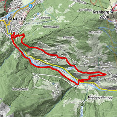
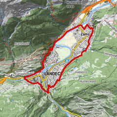
Landeck - Urgen - Fließ - Landeck
Trailrunning
11,94
km
02:09
h
337
hm
790 - 1.067
m
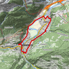
Talrunde Panorama
Courir
11,07
km
01:50
h
137
hm
760 - 857
m
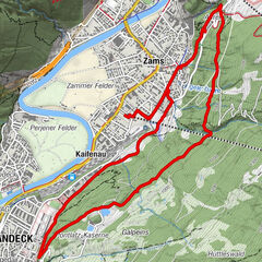
Talrunde Night
Courir
8,85
km
01:21
h
31
hm
760 - 814
m
Tramsrunde NordicWalking
Courir
8,41
km
01:28
h
197
hm
767 - 974
m
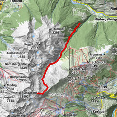
Flath Alm - Ascherhütte - Fisser Jöchl
Trailrunning
35,64
km
08:34
h
2.242
hm
790 - 2.668
m
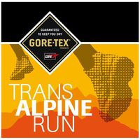
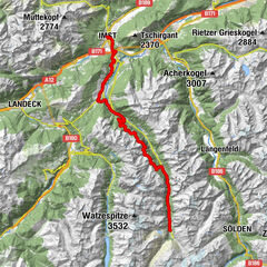
GORE-TEX® TRANSALPINE-RUN 2016 3. Etappe
Trailrunning
48,96
km
05:00
h
3.037
hm
715 - 2.292
m
GORE-TEX Transalpine Run 2018 3. Etappe_NEU
Trailrunning
51,73
km
10:55
h
3.163
hm
709 - 2.226
m
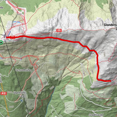
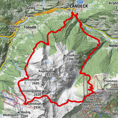
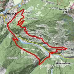
Landeck - Hochgallmigg - Fließ
Trailrunning
17,47
km
03:42
h
859
hm
790 - 1.222
m
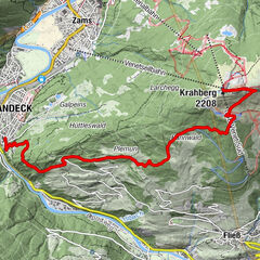
Landeck - Trams - Krahberg
Trailrunning
8,68
km
01:35
h
-
816 - 2.201
m
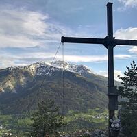
Kluppenkreuz Landeck, Tirol
moyen
Trailrunning
4,5
2,93
km
00:29
h
340
hm
914 - 1.252
m
Technique
Endurance
Stanz - Grins
Marche nordique
6,81
km
01:22
h
178
hm
1.000 - 1.176
m
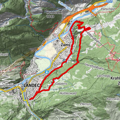
Landeck - Trams - Galugg
Trailrunning
11,28
km
01:58
h
252
hm
759 - 973
m
Parcours par type
Randonnée
Bike
Hiver
Fonctionnement
Alpin
Motorsport
Trailrunning
Courir
Marche nordique
Touren nach Regionen
Naturpark & Gletscherregion Kaunertal
35
Tiroler Oberland
39
Gipfeltouren in der Region
Rotpleiskopf (2.936 m)
4
Glanderspitze (2.512 m)
13
Hohe Aifnerspitze (2.779 m)
6
Wannejöchl (2.497 m)
7
Frommes (2.488 m)
4
Vorderer Brunnenkopf (2.682 m)
6
Kreuzjoch (2.464 m)
8
Piller (2.480 m)
10
Zwölferkopf (2.596 m)
11
Hinterer Sattelkopf (2.670 m)
6
Randonnées populaires dans la région
Fließ - Gogles Alm - Glanderspitze
Ski de randonnée
4,67
km |
1260
hm |
01:50
h
Hochgallmigg - Planskopf
Ski de randonnée
9,06
km |
1377
hm |
04:07
h
Gogles Alm
moyen
Randonnée
3,1
km |
336
hm |
04:00
h
Grist - Venetbahn Bergstation
Ski de randonnée
5,39
km |
973
hm |
01:48
h
Voisin
Faggen
Prutz
Kauns
Ried im Oberinntal
Ladis
Régions favorite
Innsbruck
Lienz
Kufstein
Reutte
Imst
Tannheimer Tal
Neustift im Stubaital
Schwaz
Längenfeld - Huben - Gries
Leutasch
Seefeld in Tirol
Telfs
Ischgl
Matrei in Osttirol
Wörgl
Kals am Großglockner
Gries am Brenner
Steinach am Brenner
Hall in Tirol
Umhausen im Ötztal
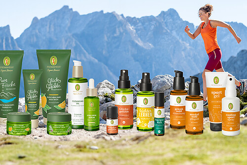
Jeu-concours
Produkt-Paket für die ganze Familie
Primavera XXL-Gewinnspiel
Aucune entrée trouvée.
La recherche n'est actuellement pas disponible.
Veuillez affiner votre recherche.
Résultats de recherche locaux
(<= 25km)
Plus de résultats
(> 25km)
%count% Résultat de la recherche
%name%
%type%
%elevation%
%population%
%lpButton%