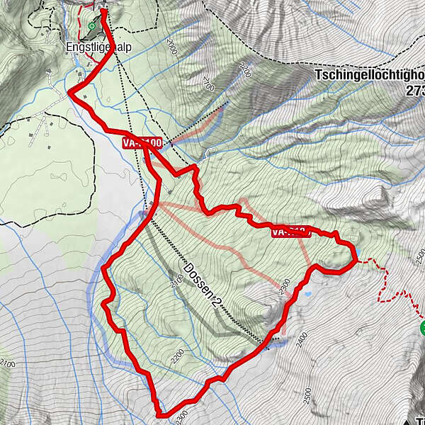
Engstligenalp – Dossenseeli – Engstligenalp (Seeli-Weg)

Randonnée


- Difficulté
-
moyen
- Évaluation
-
- Parcours
-
Engstligenalp0,3 kmEngstligenalp7,8 km
- Meilleure saison
-
janv.févr.marsavrilmaijuinjuil.aoûtsept.oct.nov.déc.
- Description
-
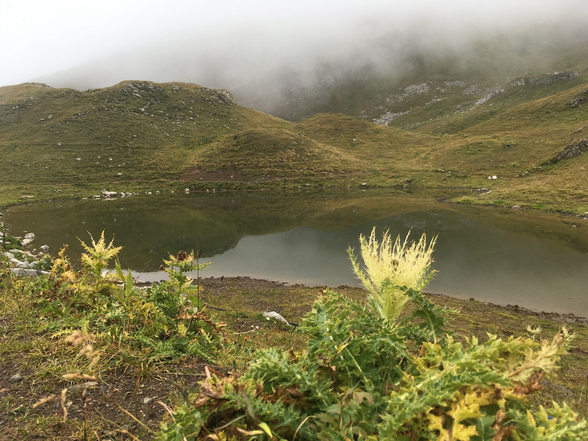
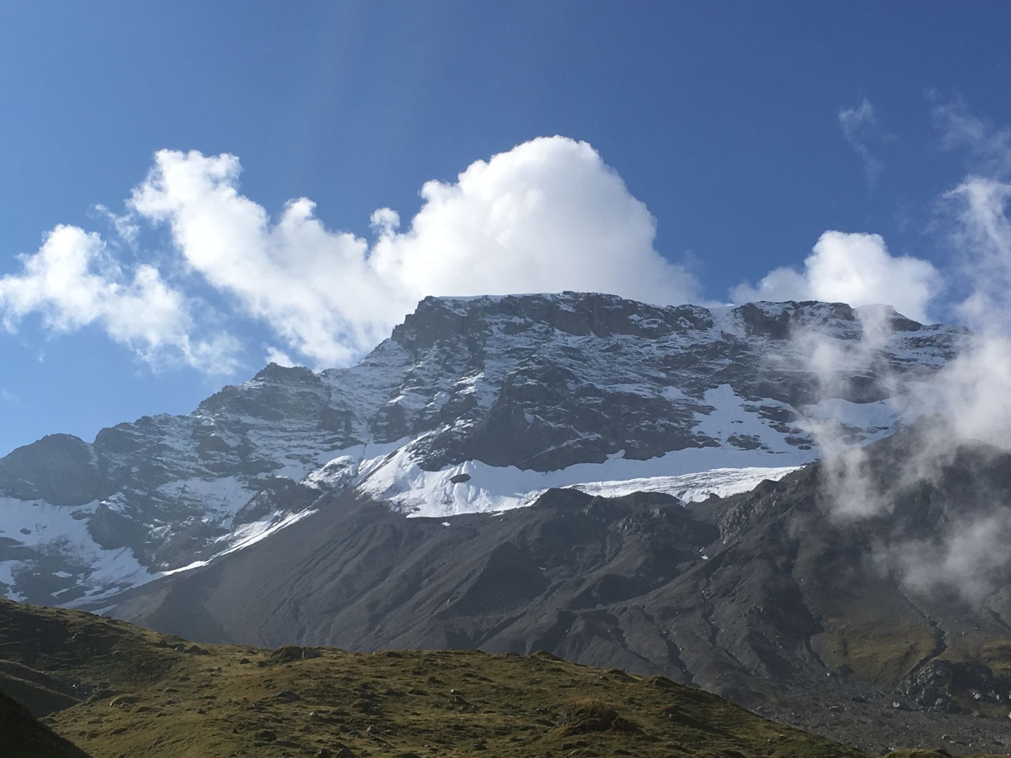
Arrived at Engstligenalp, you first hike along the flat circular trail. Soon you will be heading steeply uphill towards the Chindbettipass and Tschingellochtighorn to the Dossen-Seeli. There you can enjoy your lunch with an impressive view. At the edge of the alluvial area of the Wildstrubel you come back to the flat plateau.
- Hauteur maximale
- 2.339 m
- Point de mire
-
Bergstation Engstligenalp
- Profil en hauteur
-
 © outdooractive.com

-

-
AuteurLa randonnée Engstligenalp – Dossenseeli – Engstligenalp (Seeli-Weg) est utilisé par outdooractive.com fourni par.
GPS Downloads


Informations générales
Point de rassemblement
Prometteur
Autres parcours dans les régions
-
Oberwallis
1880
-
Adelboden
988
-
Leukerbad
305


