Fellhornbahn - Enzianhütte

Logo Fellhornbahn - Enzianhütte
Dates des itinéraires
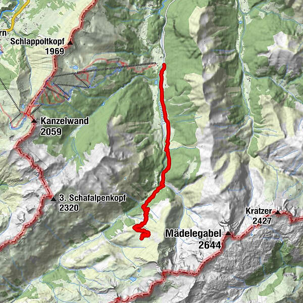
16,96km
911 - 1.785m
Distance
917hm
917hm
Montée
05:20h
 
Durée
Brève description

nicht ohne Anspruch.

Difficulté
difficile
Évaluation
Technique
Endurance
Paysage
Résultat
Parcours
Anatswald
0,9 km
Birgsau
2,0 km
Adler-Landhaus Birgsau
2,0 km
Wendelins-Kapelle
2,2 km
Alpe Eschbach
2,4 km
Berggasthof Einödsbach
4,3 km
St. Katharina
4,4 km
Einödsbach
4,4 km
Enzianhütte
8,6 km
Einödsbach
12,6 km
St. Katharina
12,6 km
Berggasthof Einödsbach
12,6 km
Alpe Eschbach
14,4 km
Wendelins-Kapelle
14,6 km
Adler-Landhaus Birgsau
14,7 km
Birgsau
14,8 km
Anatswald
15,9 km
Hauteur maximale
1.785 m

Évaluation globale

5

0

%

4

0

%

3

0

%

2

0

%

1

0

%

Erreur
Une erreur est survenue. Veuillez réessayer.
Merci pour votre évaluation

L'évaluation a été supprimée

GPS Downloads
  • GPX GPS Exchange Format (XML)
  • KML Google Earth, Google Maps
Codes de téléchargement QR pour les téléphones portables
Autres parcours dans les régions

Randonnées populaires dans la région

Braunarlspitze

difficile Randonnée
16,57km | 1430hm | 08:00h

Gerstruben - zum historischen Bergbauerndorf

moyen Randonnée
12,84km | 277hm | 06:00h