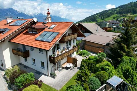
La commune de Kolsass, située à une altitude de 553 m, se trouve à une dizaine de kilomètres de Schwaz. Ce village de 1500 habitants est l’endroit idéal pour passer des vacances reposantes dans la région d’argent du Karwendel.
Cette commune du Tyrol fut mentionnée pour la première fois dans les annales en l’an 1050. Cependant, il semblerait qu’une paroisse (qui devint par la suite mère-paroisse au VIIIe siècle) existait déjà à cet endroit depuis plusieurs siècles.
Le Kolsass que l’on connait aujourd’hui est issu de deux zones: le centre du village avec son église et le hameau de Mühlbach. On présume que le nom de la commune de Kolsass provient du rhéto-romand. Il est composé des mots de « Col » et « Sass » qui signifient « colline » et « rocher » et décrivent la colline où fût érigé le château de Rettenberg qui fait aujourd’hui partie de la commune voisine de Kolsassberg.
Autrefois, la ville exportait des marchandises vers le Tyrol du Sud qui transitaient par la vallée de Weertal.
Les vacanciers pourront en été pratiquer diverses activités comme: le jogging, la marche nordique, la randonnée pédestre et VTT. En hiver, vous pourrez profiter de la petite remontée mécanique de Kolsassberg et des pistes préparées de ski de fond de la région d’argent du Karwendel ou bien faire une partie de descente en luge sur une des nombreuses pistes de luge du domaine. Ceux qui préfèrent la nature et l’air libre pourront marcher en raquettes à neige vers les croix des sommets en passant par des champs couverts de neige vierge. Les moins sportifs apprécieront une ballade en luge tirée par des chevaux ou une promenade hivernale en toute tranquillité.
Conseils loisirs Kolsass

Montrer tous les activités loisirs
Contacter Kolsass

TVB Silberregion Karwendel
Münchner Straße 11, A-6130 Schwaz
- Téléphone
- +43 5242 63240
- FAX
- +43 5242 63240 99
- Page d'accueil
- https://www.silberregion-karwendel.com/de-at/da...
Demande de renseignement et Commande de prospectus Hébergements

- Hôtel 4
- Location de vacances 6
- Ferme 1
- Refuge 1
- Chalet 3
- 1 day ago
- 1 day ago
- 1 day ago